Film Automating the process of making original maps. (1986)

Part 1
0:09:29
Part 2
0:09:50Automating the process of making original maps (1986)
Annotation:
The film describes the process of mapping with the use of computers and other automatic machines.
Reel №1


Cartographers at work.
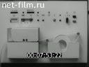
Devices that allow you to make maps.
Shooting the terrain with the help of modern devices.
Compact media with information.
Aerial photography of the area.
A helicopter flies over the taiga.
Mapping using automated systems.
The digitalized information is entered into a computer.
Output of information to a special device.
The cartographer reads the information using the sight.
Scanning information.
A scientific vessel at sea.
Creating a map of the seabed relief (animation).
Reel №2

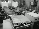

Entering information into the computer.
Computer operator.
Output of cartographic information from a computer.
A graph builder powered by a computer.
Projections used to translate information from the spherical surface of the Earth to the flat surface of the map (animation).
Training of future cartographers in the use of calculators and keyboard computers.
Lesson in the display class of the Institute of Geodesy of Aerial Photography and Cartography.
Automatic map construction.
The meteorologist takes readings.
The machine makes meteorological and synoptic maps.
The CASCADE photo set is typing geographical names.