You found 739 newsreels for query "remote%20areas%20of%20the%20planet"
"remote%20areas%20of%20the%20planet" newsreels and historical clips
Russian singer remote 1990
Documentary, 1 part, duration: 0:09:59, published: 10/25/2013
Reel №1 Russian singer remote


Remote island of Kunashir 1968
Documentary, 2 parts, duration: 0:19:04, published: 8/11/2014


New in the operation of pipelines 1975
Documentary, 2 parts, duration: 0:19:48, published: 3/24/2023
Reel №2


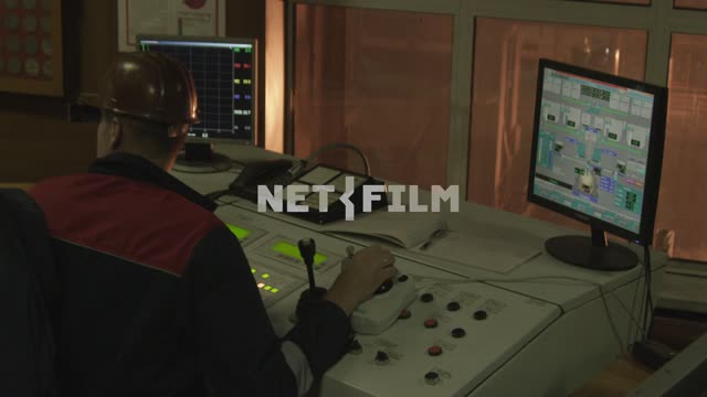
Remote control point.
The device of a remote control point.
Operation of the remote control point (animation).
The operator at the control panel.
Storage tanks for petroleum products.
Gate valves that block the flow of products.
Laboratory experience.
Level sensors (animation).
Operator's console.
Remote ...
Telemechanika of power supply 1968
Documentary, 2 parts, duration: 0:20:07, published: 7/22/2014
Reel №1
...


... center with remote control, the dispatcher.
Diagram remote control, remote signaling.
Substation.
Electrical equipment.
Switchgear.
Plan of electrical networks.
The monitoring system.
Semiconductors.
The engineer collects electronic circuits, modules, blocks.
Control point (device).
EST62. Remote signaling ...


... signaling scheme.
Control point (device).
EST62. Remote signaling scheme.
Reel №2


Remote signaling scheme.
Manager for the remote control. "Dark Shield" with the switches.
Transmitter, receiver frequency.
Manager on headphones listening to the alarm code.
Power dispatcher presses the button on the remote control.
The coding scheme of remote control.
Electromagnetic relays.
Engineer ...
Eletskaya railroad. 2013
Footage, 11 footages, duration: 0:02:04, published: 3/1/2016
Scene №2


Manager of the remote control.
Scene №3


Manager of the remote control.
Remote coarsely.
The sons of Gesar 1991
Documentary, 4 parts, duration: 0:39:06, published: 5/5/2015
Annotation
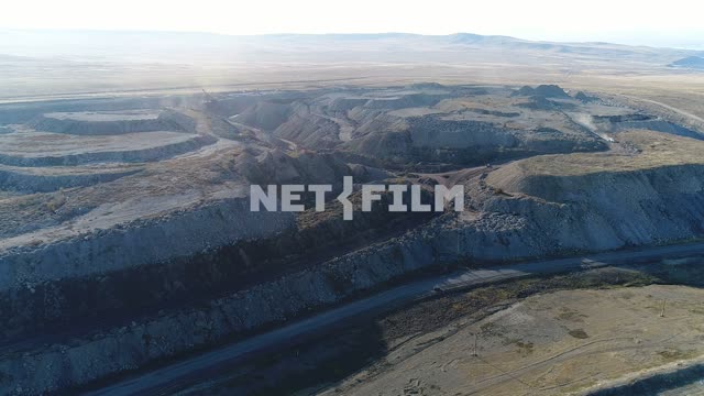
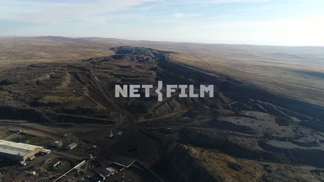
The film tells about the challenges and achievements in the development of remote regions of Siberia.


Roscosmos, archive. Military-technical Forum "Army 2022" 2022
Footage, 7 footages, duration: 0:19:31, published: 6/29/2023
Scene №5


... artificial intelligence "Digital Earth", new technologies for the development of satellite navigation and other projects designed for remote sensing systems of the Earth (remote sensing).
Comment by Elena Natarova.
People backwoods 1981
Documentary, 2 parts, duration: 0:18:38, published: 1/6/2015
Annotation
A film about remote parts of Siberia that soon will be connected by the Baikal-Amur railway.


Nerses Hovhannisyan Gedeonovich interview 1996
Footage, 1 footage, duration: 0:01:21, published: 3/18/2016
Scene №1 Nerses Hovhannisyan Gedeonovich interview


Hardware video editing.
Remote control, monitors.
Nerses Hovhannisyan Gedeonovich talks about working on a new film about the Soviet directors and actors.
In the frame of the actors Alexei Batalov, Tatiana Samoilova.
Nerses Hovhannisyan with the editor of the remote control.
Nerses Hovhannisyan says ...
debriefing (№ 8 ) How remote sensing satellites help the Ministry of Emergency Situations 2022
Telecast, 1 part, duration: 0:37:29, published: 7/6/2023
Reel №1


... operational use of satellite data of remote sensing of the Earth (remote sensing).
This allows you to see a more complete picture of what is happening and better navigate in emergency situations, including using geographic information systems (GIS).
The issue is dedicated to remote sensing of the Earth in crisis ...
...